Twinning Open Data Operational

Funded within Horizon2020 Twinning programme

News

WHAT IS NEW IN TODO
01.06.2023, 07:37
One way to formalise future collaboration after the completion of the TODO project is to establish a research group. The project consortium partners…
31.05.2023, 22:26
As a part of the WP6, Task 6.2 - Establishment of collaboration structure, the Memorandum of Understanding was signed among all partners of the TODO…
17.04.2023, 08:21
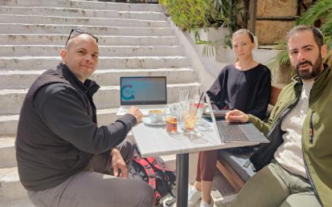
Faculty of Transport and Traffic Sciences’ final visit to the University of the Aegean in Athens (UAEGEAN) took place from March 28 to March 30, 2023…
10.02.2023, 07:40
We are pleased to announce that the members of the organising committee of the International Conference on Open Data (ICOD 2022), whose theme was "…
31.01.2023, 14:51
In Croatia, open data research and research using it are mostly understood as a concept encompassing one discipline and one domain, ignoring the fact…
07.12.2022, 14:47
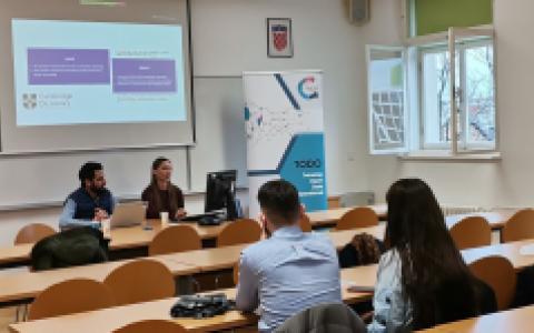
Pre-Conference Day of TODO ICOD was held on Monday (28.11.2022.) where a panel on fiscal transparency and workshop on high-value datasets in progress…
OUR PROGRESS

Project analytics

Progress within core work packages

WP 1: Management and Coordination
100%
WP2: Capacity building
100%
WP3: ESRs training and Joint Supervision
100%
WP4: Collaboration and Knowledge Sharing
100%
WP5: Dissemination and Outreach
100%
WP6: Sustainability
100%

Geographic data

Geographic data link place, time, and attributes. Some attributes are physical or environmental in nature, while others are social or economic”

Source: Longley, P.A., M.F. Goodchild, D.J. Maguire, and D.W. Rhind, 2001, Geographic information Systems and Science, Chicester, England (John Wiley and Sons Ltd), pp 64-65.

GeoJSON

A dialect of JSON with specialised features for describing geodata, and hence a popular interchange format for geodata.

GPS

The Global Positioning System, a satellite-based system which provides exact location information to any equipment with a suitable receiver (including modern smartphones). GPS is invaluable to many location-based apps, providing users with e.g. route-finding information or weather forecasts based on their current location.

GNU General Public Licence (GPL)

The GNU General Public License is a free, “copyleft” license for software and other kinds of works in a sense that it protects the freedoms – the rights - of users of thus licensed software instead of focusing on the moral and material rights of authors within the recognized and almost universally accepted framework of copyright and neighbouring rights.

GIS

Geographical Information System, any computer system designed to read, display, analyse and manipulate geodata.

Source: ODH

GDPR

Key EU legislation on the personal data protection and privacy. The General Data Protection Regulation (EU)2016/679 is in force since May 2018 in the EU and EEA countries. It aims to give the individuals control over their personal data, requires all data controllers to establish procedures and safeguards, and is very strict towards breaches committed by private companies.

Formal open standard

As defined by the OD Directive, ‘formal open standard’ means a standard which has been laid down in written form, detailing specifications for the requirements on how to ensure software interoperability.

Source: OD Directive

FOAF

‘Friend of a friend’ is a machine-readable descriptive vocabulary of persons, their activities and their relations to other people and objects. FOAF allows groups of people to describe social networks without the need for a centralised database.

Five stars of open data

A rating system for open data proposed by Tim Berners-Lee, founder of the World Wide Web. To score the maximum five stars, data must (1) be available on the Web under an open licence, (2) be in the form of structured data, (3) be in a non-proprietary file format, (4) use URIs as its identifiers (see also RDF), (5) include links to other data sources (see linked data). To score 3 stars, it must satisfy all of (1)-(3), etc.

File format

The description of how a file is represented on a computer disk. The format usually corresponds to the last part of the file name (‘extension’), e.g. a file in CSV format might be called schools-list.csv. The file format refers to the internal format of the file, not how it is displayed to users. E.g.

Enabling a user-driven, sustainable and fair open data ecosystem through interdisciplinary research and education.

Delft University of Technology

Establishing the interdisciplinary approach in open data research towards addressing the societal, political and economic challenges.

University of the Aegean

Dealing with challenges and grasping new opportunities with reliable, up-to-date and easily accessible data to increase efficiency in planning, producing and delivering food to consumers.

Faculty of Agriculture, University of Zagreb

Information technologies drive open data to make government more transparent, science more visible and society more empowered.

Faculty of Organization and Informatics, University of Zagreb

Advancing technological foundations of open data as the cornerstone of an innovative society. 

Faculty of Electrical Engineering and Computing, University of Zagreb

Open traffic data provide reliable information for statistics, planning and real-time user information in interdisciplinary area. Vast amount of traffic data is essential for traffic and transport planning.
 

Faculty of Transport and Traffic Sciences, University of Zagreb

Geospatial data is one of the cornerstones of information society and the ongoing digital revolution. The vision of the University of Zagreb Faculty of Geodesy is realizing the full potential of the geospatial data - active research, promotion and education throughout the interdisciplinary approach.

Faculty of Geodesy, University of Zagreb

MOODLE